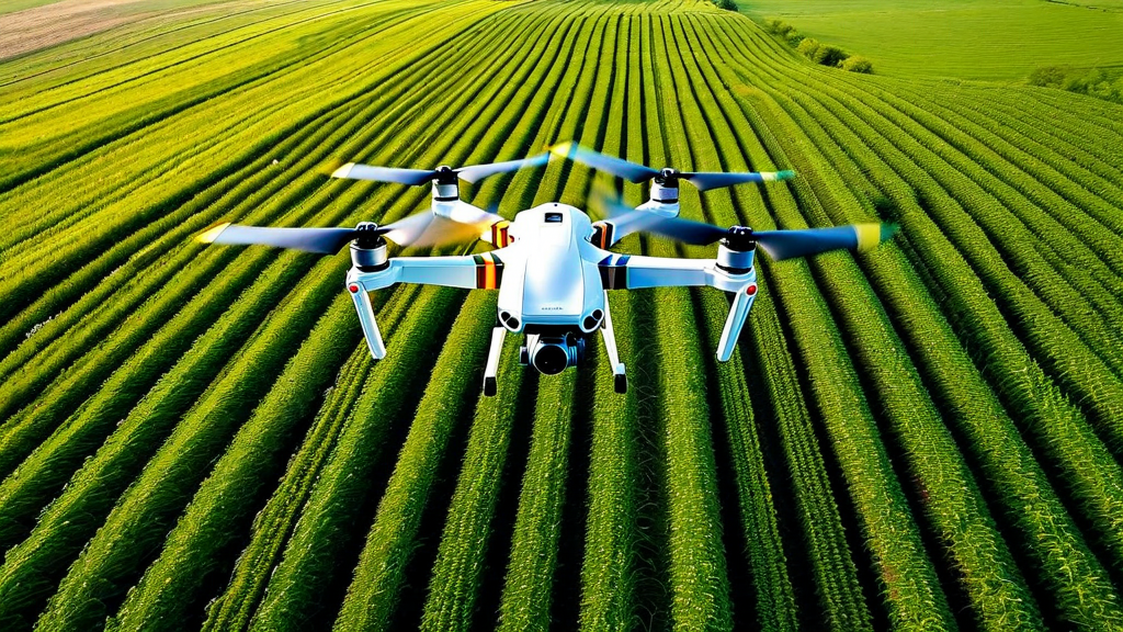
When the first commercial agricultural drones appeared on the market around 2012, most farmers dismissed them as expensive toys with limited practical value. The flight times were short, the cameras were consumer-grade, the software was rudimentary, and the regulatory environment was uncertain. A decade later, the agricultural drone market has matured into a multi-billion-dollar industry producing purpose-built platforms that can map hundreds of acres per day, apply inputs with centimeter-level precision, and generate actionable intelligence that directly improves crop management decisions.
The transformation has been driven by a convergence of hardware improvements — better batteries, lighter sensors, more capable autopilot systems — with sophisticated cloud processing platforms that can turn raw drone imagery into agronomic insights within hours of a flight. Today's agricultural drone operators have access to tools that would have seemed like science fiction to the farmers of the previous generation, and the economics have shifted to the point where drone-based services are cost-competitive with traditional crop scouting methods on farms of almost any size.
Field Mapping and Multispectral Imaging
The most widely adopted drone application in agriculture is field mapping with multispectral cameras. Unlike standard RGB cameras, multispectral sensors capture reflected light across multiple wavelengths — typically including near-infrared, red edge, and sometimes thermal bands in addition to visible light channels. This expanded spectral range enables the calculation of vegetation indices that reveal information about crop health that is invisible to the naked eye or to conventional photography.
The Normalized Difference Vegetation Index (NDVI) — calculated from the ratio of near-infrared to red reflectance — is the most widely used vegetation index and serves as a proxy for chlorophyll content and photosynthetic activity. A field NDVI map generated from a drone flight immediately reveals spatial patterns in crop vigor: uniform fields show consistent NDVI values across the image; stressed fields show a patchwork of lower values that guide agronomists directly to problem areas for investigation. The time savings relative to walking-based crop scouting are enormous, and the spatial resolution of drone imagery — typically 3 to 10 centimeters per pixel at standard survey altitudes — is far superior to what can be achieved from satellites.
Beyond NDVI, multispectral analysis enables detection of specific stress types based on their characteristic spectral signatures. Nitrogen deficiency produces a different spectral pattern than water stress, which differs from fungal disease, which differs from pest damage. Machine learning classifiers trained on labeled spectral data are increasingly able to diagnose specific issues from drone imagery with confidence levels approaching that of expert agronomists. The Brilliant Harvest platform integrates drone-derived vegetation indices with ground-based sensor data and weather records to build contextual models of field stress that go beyond what any single data source can provide.
Drone Spraying: Precision Application from Above
Agricultural sprayer drones — equipped with tanks, pumps, and nozzle arrays — represent a different but equally transformative application of UAV technology. In markets where they have been adopted at scale, notably China and Japan, drone sprayers have become the dominant method for applying pesticides and foliar nutrients to rice, wheat, and vegetable crops. The advantages over ground-based application equipment are substantial in certain contexts: drones can fly over crops at any growth stage without causing mechanical damage, can operate in fields too wet for ground equipment, can access terraced or steeply sloped terrain that is inaccessible to tractors, and can apply materials much faster per operator than backpack sprayers.
The precision advantage of drone application is most significant when combined with prescription maps generated from field imagery. A drone sprayer following a variable-rate application prescription based on a disease pressure map generated from a scouting flight applies fungicide only in the zones where disease has been detected, rather than blanket-treating the entire field. Research trials have demonstrated reductions in total chemical applied of 30 to 70 percent for targeted applications relative to whole-field treatments, with equivalent or superior control outcomes. The economic and environmental implications of this precision are considerable — chemicals are expensive, and minimizing their use reduces costs, reduces residue risks, and preserves beneficial insect populations.
Photogrammetry and 3D Field Modeling
Structure-from-motion photogrammetry — the computational technique that reconstructs three-dimensional surfaces from overlapping two-dimensional photographs — has given agricultural drones the ability to generate detailed topographic models of farm fields at sub-meter accuracy. These models, created from standard RGB drone imagery processed through photogrammetry software, reveal drainage patterns, low spots that collect water, erosion channels, compaction-induced surface depressions, and other topographic features that significantly influence crop performance.
High-resolution digital elevation models derived from drone photogrammetry are increasingly used to guide precision drainage tile installation, terrace construction, and surface grading projects that can dramatically improve water management across a field. They also provide the topographic input needed for surface runoff models that predict erosion risk and guide cover crop placement and buffer strip installation in environmentally sensitive areas. As the cost of drone surveys has dropped below five dollars per acre for basic RGB mapping missions, the cost-benefit calculation for building these digital field models has become compelling for farms of all sizes.
Plant Counting and Stand Assessment
Early-season stand assessment is a critical but labor-intensive task on corn, soybean, sugar beet, and many vegetable crops. Traditional stand counting involves walking transects through fields, manually counting plants in measured sections, and extrapolating to estimate overall stand density. This process takes hours on large fields and is subject to significant sampling error. Drone-based plant counting using high-resolution imagery and automated detection algorithms can count individual plants across hundreds of acres in a single flight, generating precise population maps that guide decisions about whether to replant compromised areas.
Plant counting algorithms trained on labeled datasets can achieve counting accuracy above 95 percent under good imaging conditions, and they provide not just total population estimates but spatial maps of where gaps occur and how large they are. This information feeds directly into economic models that estimate the yield cost of suboptimal stands and compare it to the cost of replanting — a decision that must be made quickly as the optimal replanting window is narrow. When integrated with germination rate data and weather records from the planting period, plant count data also provides valuable feedback on seed quality, planting equipment performance, and soil conditions at the time of planting.
Regulatory Landscape and Operational Considerations
The regulatory framework governing commercial agricultural drone operations in the United States has evolved considerably since the FAA's initial commercial drone regulations took effect in 2016. Under current Part 107 rules, most agricultural mapping and scouting operations can be conducted by certified remote pilots without site-specific waivers. Sprayer drones require additional compliance steps in most states, as pesticide application is regulated under EPA and state agricultural department authority regardless of the delivery method — drone operators must hold applicable pesticide applicator licenses and comply with label requirements that in some cases restrict or require specific application methods.
Operational considerations for agricultural drone programs include the need for trained pilots who understand both flight safety and agronomic interpretation, data management infrastructure capable of storing and processing large volumes of imagery, and integration pathways to get drone-derived insights into the farm management software where they can influence decisions. These operational requirements have driven the growth of drone-as-a-service providers who handle all aspects of drone operations on behalf of farms that prefer to access the data rather than operate the equipment themselves. This service model has substantially lowered the barrier to adoption and is expected to be the primary growth driver for agricultural drone utilization over the next five years.
Key Takeaways
- Multispectral drone imaging generates vegetation index maps that reveal crop stress patterns invisible to standard observation, guiding targeted scouting and intervention.
- Drone sprayers enable variable-rate precision application that can reduce total chemical use by 30 to 70 percent relative to uniform whole-field treatment.
- Photogrammetry-derived elevation models reveal drainage and topographic features that inform drainage, erosion control, and water management decisions.
- Automated plant counting from drone imagery provides fast, accurate stand assessments that guide replanting decisions within the narrow optimal replanting window.
- The drone-as-a-service model has lowered adoption barriers significantly, enabling farms to access drone data without operating their own equipment.
- Integration with ground-based sensor data and farm management platforms multiplies the value of drone-derived information through contextual analysis.
Conclusion
Agricultural drones have completed the transition from experimental technology to proven operational tool. The combination of affordable hardware, sophisticated data processing, and increasingly seamless integration with farm management platforms has made drone-based crop monitoring and precision application accessible to farms across the size spectrum. As battery technology continues to improve, autonomous operation becomes more routine, and artificial intelligence makes the interpretation of drone imagery faster and more accurate, the role of drones in agriculture will only expand. Farms that have already developed drone data capabilities are building a competitive edge that will compound in value as the technology continues to mature.